Small Carpathians hiking: trails, routes, and tips from Bratislava
Can you hike in the Small Carpathians from Bratislava?
Yes — marked trails begin at the edge of the city. The Železná studienka trailhead is 20 minutes by bus from the centre; well-marked routes range from easy 2-hour walks to full-day ridge hikes.
A mountain range that starts where the suburbs end
Most European capitals keep their forests at arm’s length. Bratislava does not. The Small Carpathians — Malé Karpaty in Slovak — rise directly from the northwestern edge of the city, and the first marked trailhead is less than 8 kilometres from Old Town. You can finish breakfast in a café on Hlavné námestie and be walking under a full beech canopy before noon, without renting a car or booking a tour.
The range runs roughly 100 kilometres from Devín in the south to Nové Mesto nad Váhom in the north, but the section closest to Bratislava — from Železná studienka to Pezinská Baba and beyond — is what most visitors explore. This stretch offers forest walks, ridge views over vineyards and the Danube plain, medieval castle ruins, and the oldest pilgrimage village in Slovakia, all linked by a well-maintained network of colour-coded trails.
This guide covers everything you need to plan a hike from the city: how to get to the trailheads by public transport, which routes suit which ability levels, what to pack, and how to end the day with a glass of wine in one of the villages at the foot of the hills.
GetYourGuideBratislava riverside, castle or complete city segway tourCheck availability →Understanding the Slovak trail marking system
Before you leave the city, it is worth understanding how Slovak trails are signed. The system is managed by Klub slovenských turistov (KST) and uses coloured blazes painted on trees, rocks, and posts at regular intervals. Once you know the colour code, navigation becomes intuitive even without a phone signal.
Red trails are ridge trails — the highest-level routes that run along the main spine of a range. In the Small Carpathians, the red trail runs the full length of the ridge from Devín to the northern end of the range. It is the backbone around which all other trails connect.
Blue trails are the main connecting routes between the ridge and the valleys or towns below. They tend to be the most direct and the busiest. The blue trail from Železná studienka to Kamzík is the most-walked route in the range.
Green and yellow trails are local routes — shorter loops, connecting paths between villages, or access paths to specific viewpoints. They are often quieter and can be combined with red or blue sections to create circular routes.
Difficulty is not formally rated on trail signs in Slovakia the way it is in Alpine countries. Instead, local maps and apps use a simple three-tier system: easy (turistická), moderate (náročná), and difficult (veľmi náročná). Most trails in this part of the Small Carpathians fall into the first two categories. The ridge itself in wet conditions requires care on some steep descents, but nothing requires technical equipment.
The best navigation tool for Slovak trails is Mapy.cz — a Czech mapping app that has outstanding coverage of Slovak hiking routes, including offline maps. Download the relevant tiles before you go, because mobile coverage on the ridge can be patchy, particularly on the western slopes.
Getting to the trailheads
Železná studienka by bus
Bus 83 runs from Hodžovo námestie in the city centre directly to Železná studienka. The journey takes around 20 minutes depending on traffic. The bus runs frequently throughout the day and the stop at Železná studienka is clearly signed. From the bus stop, the main valley path and the blue trail to Kamzík begin immediately.
This is the recommended approach for most visitors. The bus is reliable, cheap (standard Bratislava city ticket), and drops you right at the trailhead complex.
Kamzík by bus
Bus 43 serves the Kamzík area from the Patrónka stop, which is itself reachable from the centre. This approach deposits you higher up the hill, near the TV tower and the toboggan track, making it useful if you want to start your walk from a higher point or if you are combining a hike with a visit to the tower’s observation café.
Cycling to the trailheads
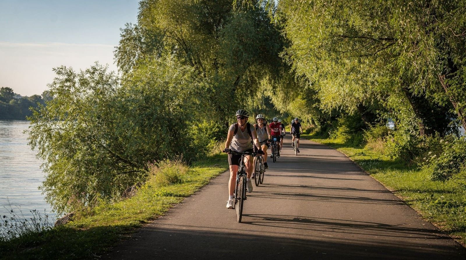
Both Železná studienka and the lower slopes around Rača can be reached by bicycle. The cycling path network in Bratislava is expanding, and there are reasonable connections from the riverside path into the forested foothills. This option suits visitors who want a full active day — cycling to the trailhead, hiking, and cycling back. See our guide to Danube riverside cycling for bike hire options and route context.
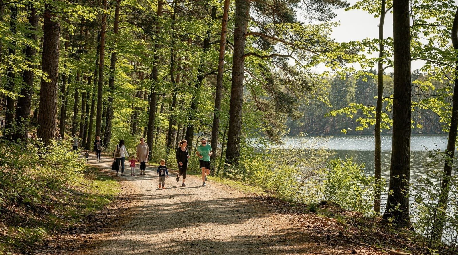
Železná studienka: the main gateway
Železná studienka translates roughly as “iron spring” — a reference to the iron-rich mineral spring that has drawn Bratislavans here for recreation since at least the eighteenth century. Today it is a pleasant valley complex with a small car park, a seasonal refreshment stand, picnic benches, and the start of several marked trails.
The valley itself is easy walking — wide paths, gentle gradient, beech and oak forest on both sides. Families with pushchairs use the lower section regularly. The mineral spring is marked but the water is not officially certified for drinking, so treat it as a curiosity rather than a refill stop.
From Železná studienka, you have several options: follow the blue trail up to Kamzík (the most popular choice), take a shorter loop on the green trail, or continue up the valley on a gentler path before joining the ridge system. The trailhead board at the valley entrance maps all the options clearly.
Route 1: Železná studienka to Kamzík hill
Distance: 3 km one-way
Elevation gain: approximately 200 metres
Time: 75–90 minutes up, 60 minutes down
Difficulty: moderate
Trail: blue
This is the defining hike of the Bratislava hills — manageable for most people, rewarding at the top, and well-signed throughout. The blue trail leaves Železná studienka and climbs steadily through mixed forest. The path is clear underfoot, though it can be muddy in spring or after rain.
At 439 metres, Kamzík is the highest easily accessible summit in the immediate Bratislava area. The TV transmission tower is visible from far below and serves as a useful landmark. At the top, the Kamzík tower complex includes a revolving restaurant at height, an observation platform, and a toboggan track (sánkovačka) that operates year-round and is particularly popular in winter.
The views from the top on a clear day extend south over Bratislava, the Danube plain, and on exceptional days to the Austrian Alps. The patchwork of vineyard and forest stretching north gives a good sense of the wider Small Carpathians landscape.
Descent can follow the same blue trail back to Železná studienka, or you can drop down via the green trail toward Rača and take a tram back to the centre — a useful option if you want a change of scenery on the return leg.
Route 2: Kamzík to Marianka via the red trail
Distance: 6 km from Kamzík to Marianka village
Total from Železná studienka: approximately 9 km
Time: 2.5–3.5 hours from Železná studienka
Difficulty: moderate
Trail: blue to Kamzík, then red ridge trail, then yellow or green to Marianka
From Kamzík, the red trail heads north along the ridge — this is the classic Small Carpathians ridge route and it feels noticeably wilder than the approaches from the city side. The forest closes in, the path narrows slightly, and the sound of the city disappears.
After roughly 6 kilometres of ridge walking, a yellow or green trail descends west into the Marianka valley. The village at the bottom, Marianka, is the oldest pilgrimage site in Slovakia, with documented pilgrimages dating to the fourteenth century. The centrepiece is the Church of the Assumption, surrounded by a baroque cloister built over centuries of donations from the faithful. Even if religious architecture is not your main interest, the complex is striking in its wooded valley setting, and the village itself is peaceful and authentic — unchanged in character by tourism.
There is a small guesthouse and seasonal restaurant in Marianka, making it a viable endpoint for a full-day walk. Bus connections from Marianka back toward Bratislava are limited; check the schedule in advance, or arrange a taxi for the 15-kilometre return to the city.
GetYourGuideBratislava riverside, castle or complete e-scooter tourCheck availability →Route 3: Pezinská Baba ridge walk
Distance: variable — 5–12 km depending on start and end points
Time: 2–5 hours
Difficulty: moderate to moderately demanding
Trail: red (ridge), with various access trails
Pezinská Baba is a summit and forested plateau in the central section of the Small Carpathians, above the wine town of Pezinok. It is less visited than the Kamzík area because getting there requires either a longer walk from the Bratislava side or a bus to Pezinok and then a climb up through the vineyards.
The reward is the view. From the Pezinská Baba area on the red ridge trail, you look east over the foothills and vineyards surrounding Pezinok, Svätý Jur, and Modra — the heart of the Small Carpathians wine region. On a clear autumn afternoon, with the vines turning gold and red, this is one of the finest views in the region.
The red trail along the ridge connects north and south, allowing combinations: walk up from Pezinok on a blue or green trail, follow the ridge north or south for as long as you wish, then descend to another wine village. Svätý Jur, about 20 minutes by bus from Bratislava, is a particularly good endpoint — a historic walled town with several small wineries that welcome walk-in tastings.
For more detail on wine villages and tasting options at the foot of the hills, see our Small Carpathians wine guide.
Route 4: ridge descent to Červený Kameň castle
Distance: approximately 8 km from the ridge descent point to the castle
Time: 3 hours descent from Pezinská Baba
Difficulty: moderate
Trail: red to junction, then yellow or green to castle
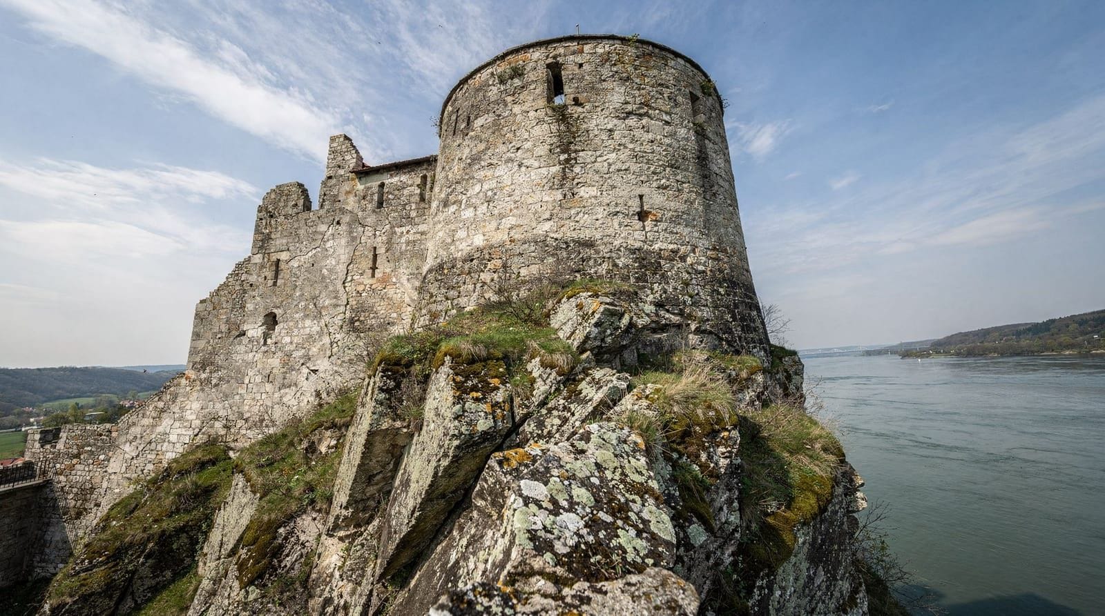
One of the most satisfying ways to end a ridge walk is to descend not to a wine village but to a medieval castle. Červený Kameň (Red Stone Castle) sits at the western foot of the Small Carpathians near Častá village, and the hiking trails that descend from the ridge toward it make for a rewarding endpoint to a full-day route.
The castle itself is one of the best-preserved in Slovakia — a Renaissance fortress built in the sixteenth century to protect the Hungarian crown jewels and the wealth of the Fugger banking family. It operates as a museum with well-maintained interiors, period furniture, and regular guided tours. Unlike the romantic ruin at Devín, Červený Kameň gives you a full picture of how a wealthy fortified residence actually functioned.
The castle has a café and restaurant in the courtyard. Bus connections from Častá back toward Bratislava or Pezinok run several times daily. This route works best as a one-way hike from the ridge — either arrange a return journey in advance or be flexible about timing.
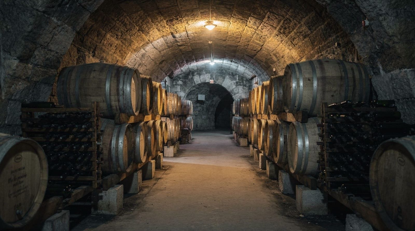
Wine village endpoints
One of the genuinely unusual pleasures of hiking in the Small Carpathians is that many trail descents end in wine villages rather than anonymous car parks. Several are worth knowing about:
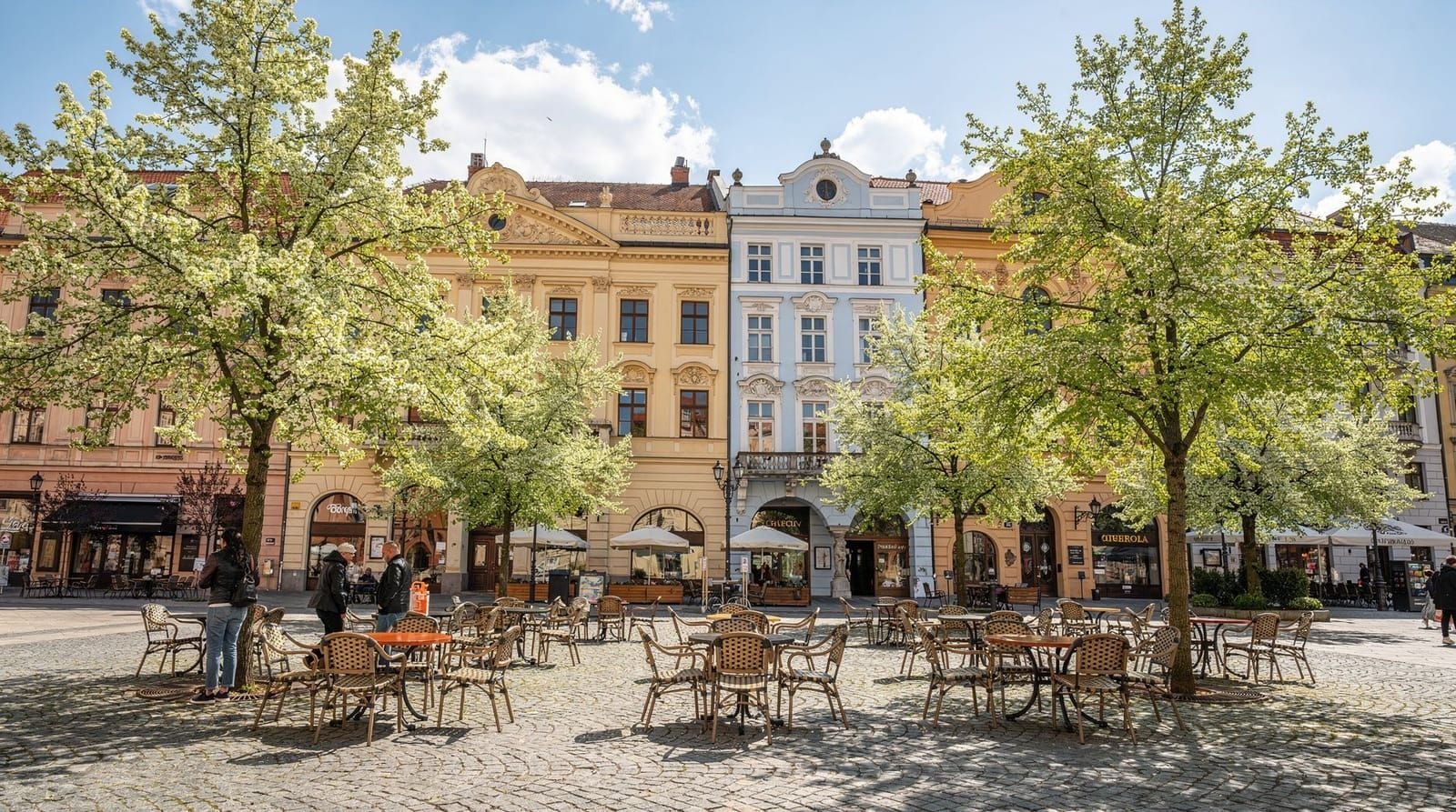
Svätý Jur is the closest to Bratislava — about 20 minutes by bus — and one of the most historically interesting. Its medieval walls survive in good condition, and several small family wineries offer tastings in the village. After a morning hike from the ridge above, arriving in Svätý Jur mid-afternoon for a glass of Welschriesling or Frankovka modrá is a very civilised way to end the day.
Rača is technically part of Bratislava but feels like a wine village — quiet streets, vine-covered slopes, several producers who welcome visitors. It sits at the southern end of the Small Carpathians wine zone and is reachable by tram from the city centre, making it an easy endpoint for hikes from the Kamzík area.
Pezinok is the main wine town of the region, with a more developed tasting infrastructure than the smaller villages. It has regular bus connections to Bratislava and several restaurants alongside its wineries.
GetYourGuideBratislava city, Iron Curtain and bunker by e-bike tourCheck availability →Best seasons for hiking
Spring (April–May) brings wildflowers — wood anemones, hepatica, wild garlic — and the beech forest shows its most vivid early green. The light is soft and walking is pleasant. The downside is that higher trails can be muddy well into May, and some north-facing slopes retain snow patches in early April. Bring waterproof boots rather than trail runners if you are heading for the ridge.
Summer (June–August) is warm and the forest provides good shade on lower trails. The ridge itself can be hot and exposed on clear days, so carry more water than you think you need and make an early start if you are planning a full-day route. Late afternoon thunderstorms are possible in July and August — keep an eye on the sky and descend before they build.
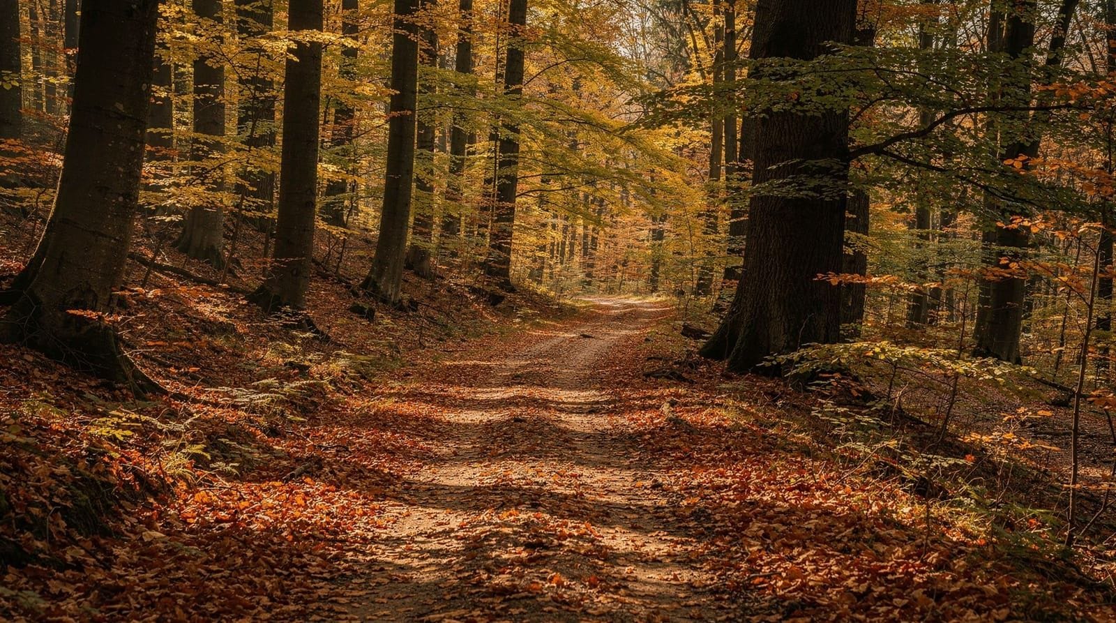
Autumn (September–November) is the best season for most hikers. The beech forest turns extraordinary shades of copper, orange, and gold through October. Mushroom picking is a Slovak national pastime and the forests are full of people with baskets on autumn weekends — a cheerful atmosphere. Trail conditions are usually excellent. The wine harvest coincides with autumn walking, making wine village endpoints especially rewarding.
Winter (December–February) transforms the ridge into a quieter, more solitary place. With snow cover, some sections become snowshoeable, and the views are clear and sharp. Standard hiking boots with microspikes are adequate for most conditions; check trail conditions locally before heading to the ridge in icy weather. The Kamzík toboggan track operates in winter and makes for a fast, fun descent.
What to bring
Footwear: Trail runners with decent grip are adequate for the Železná studienka–Kamzík route in dry conditions. For ridge walks, particularly in spring or autumn, waterproof hiking boots are preferable. The ridge trail has some rocky, uneven sections where ankle support helps.
Water: Carry more than you expect to need. The mineral spring at Železná studienka is not certified for drinking. There are no reliable water sources on the ridge itself. For a half-day walk, 1.5 litres per person is a reasonable minimum; for a full-day route, carry 2–3 litres or plan stops in villages.
Navigation: Download Mapy.cz before you leave and download the offline map for the Bratislava and Small Carpathians region. The app shows all marked trails with colours, difficulty ratings, and distances. Signal on the ridge is patchy but the offline maps work without connection. A paper map from a Bratislava bookshop or tourist centre is a useful backup.
Clothing layers: The ridge can be 5–8 degrees cooler than the city below, and a breeze picks up on exposed sections. Even in summer, a light windproof layer is worth packing.
Sun protection: Summer ridge sections are exposed. Sunscreen and a hat matter more than most visitors expect.
Wildlife
The Small Carpathians support a healthy woodland ecosystem. Deer are common and often visible at dusk and dawn near the forest edges. Wild boar roam the forest and are more often heard than seen — keep dogs on the lead and make enough noise on narrow trails that you do not surprise them at close range. Foxes are frequently spotted.
Lynx have been recorded in the Small Carpathians, though sightings are exceptional rather than expected. The area also has a diverse bird population: woodpeckers are audible in the forest throughout the year, and raptors including honey buzzard and short-toed eagle hunt the open areas along the ridge in summer.
If you are bringing a dog, keep it on a lead in areas marked as wildlife management zones — the signs are in Slovak but easy to recognise from the silhouette graphics.
Safety
Daylight: The ridge trails in particular should not be started late. From trailhead to ridge and back is a minimum of 4–5 hours for most walkers; plan to be back at the trailhead well before dark.
Mobile coverage: Signal on the ridge and western slopes is unreliable. Tell someone where you are going and when you expect to return. Download offline maps before leaving.
Weather: Afternoon thunderstorms in summer can arrive quickly. Check the forecast before setting out and have a plan to descend if conditions deteriorate.
Trail conditions in winter: Some descents become icy. Microspikes are cheap, packable, and make a significant difference on frozen paths.
Frequently asked questions about hiking the Small Carpathians from Bratislava
How do I get to the Železná studienka trailhead from the city centre?
Take bus 83 from Hodžovo námestie in the centre of Bratislava. The journey takes around 20 minutes and drops you directly at the Železná studienka valley complex, where the trails begin. Buses run regularly throughout the day.
Do I need hiking boots, or are trainers enough?
For the main route to Kamzík via the blue trail, trail runners or sturdy trainers are adequate in dry conditions. If you are planning a ridge walk or going out in spring when trails are muddy, waterproof hiking boots are a better choice. The ridge has some rocky, uneven sections.
Are the trails well-signed in English?
Trail signs use the colour-coded KST blaze system — red, blue, green, and yellow — with distances in kilometres marked at junctions. Signs are in Slovak but the system is easy to learn. Download Mapy.cz before you go; it maps all trails clearly and works offline.
Can I hike from Bratislava to a wine village and get the bus back?
Yes — this is one of the most enjoyable ways to spend a day. Svätý Jur is the most accessible endpoint by public transport, with several buses daily back toward Bratislava. Rača is reachable by tram. For Marianka and more remote endpoints, check bus schedules in advance as services are less frequent.
Is it safe to hike alone in the Small Carpathians?
Yes, for the main routes near Bratislava. The trails around Železná studienka and Kamzík are popular and well-visited. On the ridge and in more remote sections, let someone know your plan, carry offline maps, and be aware that mobile coverage is patchy. Wild boar are present but confrontations are very rare if you make noise and keep dogs leashed.
What is the best time of year to hike in the Small Carpathians?
Autumn — September to early November — is the peak season for good reason: excellent trail conditions, spectacular beech forest colours, and the wine harvest at the foot of the hills. Late spring (May–June) is a close second for wildflowers and fresh greenery. Summer is enjoyable on lower forest trails but hot on the exposed ridge.
For guided walking experiences that combine the Small Carpathians landscape with the wider Bratislava region, see our guide to the Small Carpathians day trip from the city. If you prefer to explore the lower hills on two wheels, the Danube riverside cycling guide covers the flat riverside route west to Devín Castle.
Slovak wine experiences on GetYourGuide
Verified deep-linked GetYourGuide tours. Book through these links and we earn a small commission at no cost to you.